
- Joined
- Oct 2, 2009
- Messages
- 3,962
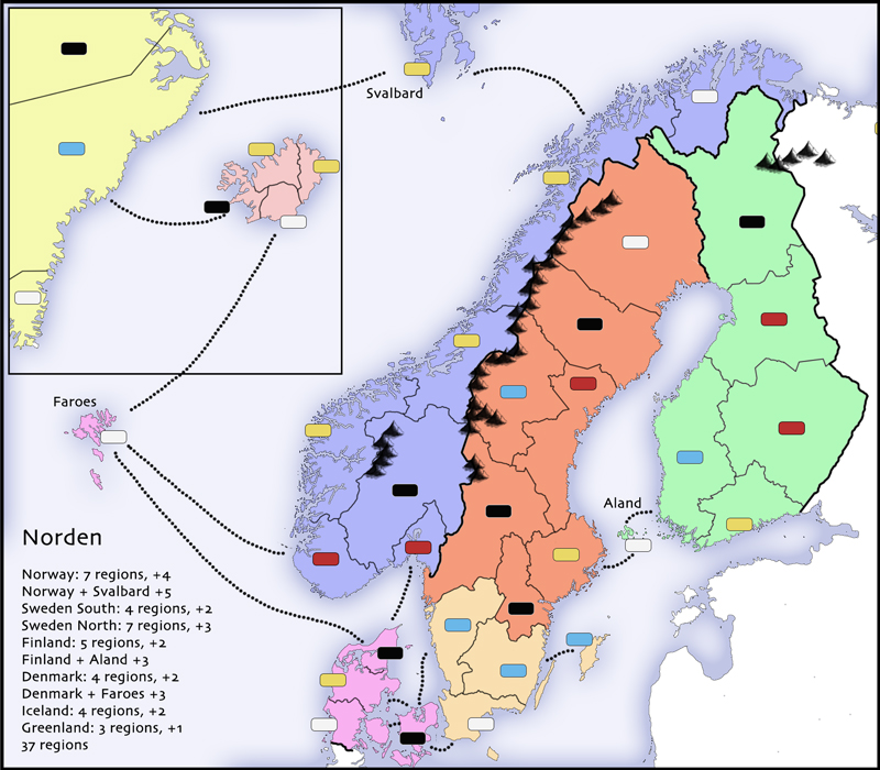
This would be a map of the Nordic Counties - Denmark, Sweden, Norway, Finland, Iceland, and the associated islands.
It's not a large map, it's not a complex map, and it doesn't have any whistles and bells. The justification for making a smallish, straightforward map is that the majority of active games at this site right now are two-four players on the classic maps. Plus, now that real-time games seem to be working more smoothly than in the past, smaller maps make for better RT games in my opinion.
The present layout has 37 regions, 8 commands, and three small bonuses you can tack on to commands you already hold.
The map doesn't look like much at the moment, but I already know where its going to go visually - I just need to commit some time to making it happen. So yes, the sea routes and the mountains the colors look awful - everything is just there to start the conversation. I'd rather not spend hours on the visuals until I know we have something.
For now I'd appreciate any feedback, especially concerning the regions divisions - I don't know the region myself, and I'm just using existing political borders between regions of the countries. Also, if any the sea routes look impossible or ridiculous please let me know.
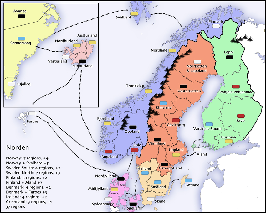


")